
Cerritos ZIP Code 90703 Coverage
Official City documents identify 90703 as the Cerritos ZIP code. The standard delivery area includes the city's residential, civic, and commercial addresses, with PO Boxes at the Cerritos Post Office. A postal area does not promise that every address carrying the city name falls inside the incorporated boundary, so a ZIP answer should be kept separate from a municipal or parcel answer.
| ZIP Code | Areas Covered | Post Office | Notes |
|---|---|---|---|
| 90703 | Cerritos residential, civic, and commercial delivery area | Cerritos Post Office, 18122 Carmenita Road, Cerritos, CA 90703-9998 | Standard delivery ZIP with PO Boxes; verify every edge address |
No official source reviewed documents a separate unique or PO-box-only ZIP for Cerritos, a city ZIP pocket in 90701, or a ZIP split or realignment year. The safest Cerritos ZIP code directory statement is therefore narrow: 90703 is the city's identified ZIP, while individual delivery addresses still need USPS verification.
A Postal ZIP Is Not Cerritos
A ZIP code is assigned for mail delivery. An incorporated city limit is a legal boundary. The two can overlap without matching. The city name printed on a mailing label is not a deed, a voter record, or a parcel jurisdiction. The Los Angeles County Assessor's situs city can also reflect an assessment convention, neighborhood designation, or cluster label, so save the postal answer and the parcel answer as separate fields.
Los Angeles County's geography and government structure explains why county custodians remain responsible for Cerritos records even when a postal search shows a neighboring delivery point. Use Cerritos GIS for the municipal map, the Assessor for the AIN and situs, and USPS for the current delivery format. That three-part check is stronger than a city label alone.
The Los Angeles County geography reference used for this ZIP directory supplies the county-level context behind a Cerritos postal search.
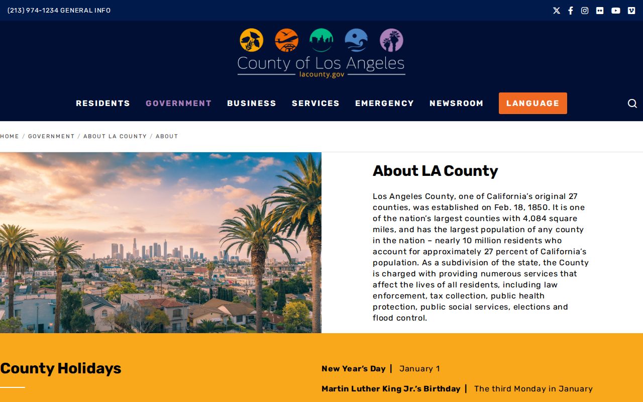
Keep that county context beside the USPS result. It explains the custodian relationship without treating a postal label as proof of a resident or parcel.
- ZIP code
- A five-digit USPS delivery area used to sort and route mail.
- ZIP+4
- The nine-digit extension that narrows delivery within the five-digit area.
- PO-box ZIP
- A ZIP or delivery arrangement centered on post-office boxes rather than ordinary street delivery.
- Unique ZIP
- A postal code assigned to one large institution or special destination; none was verified for Cerritos in the research.
- Carrier route
- A postal delivery path inside a ZIP, not a city boundary or public resident roll.
Verify Cerritos Edges with USPS
USPS ZIP Code Lookup is the authority for one current mailing answer. A successful result can standardize the street suffix and direction, city and state, five-digit ZIP, ZIP+4, and delivery format. The city-and-state route is helpful for confirming that 90703 is the postal identity associated with Cerritos, while the address route is needed for a particular parcel.
| Street address | Enter the delivery address; use the complete number, street, unit, and direction when known. |
|---|---|
| City and state | Tests the postal city label, which may not be the legal city limit. |
| ZIP | Returns the five-digit delivery area for the verified address. |
| ZIP+4 | Narrows the delivery point inside the five-digit ZIP. |
| Standardized format | Use USPS's normalized suffix, direction, city, state, and postal presentation in later requests. |
The USPS capture used for the Cerritos ZIP code directory is a postal verification aid, not an ownership or household lookup.
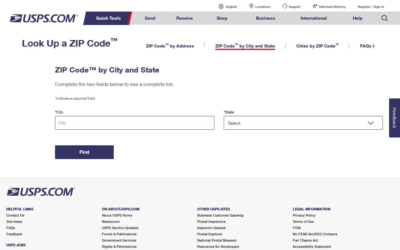
Save the standardized result beside the Assessor situs and AIN. If the three answers differ, investigate the address instead of choosing the one that fits the searcher's assumption.
Search Cerritos Residents ZIP by ZIP
A ZIP-wide resident search has to be assembled from records that actually accept a ZIP or address. The Assessor Portal documents address and AIN search, not an unrestricted ZIP-only owner roll. Cerritos GIS is map and parcel oriented. The LA County voter status form asks for a ZIP as part of a personal match, not as a street browse. An approved voter file may be filtered by ZIP only for a permitted purpose.
- Verify the target address or city-and-state answer through USPS, then preserve the standardized form.
- Search the Assessor by address or AIN and capture each parcel's situs and assessment fields.
- Use Cerritos GIS to check municipal jurisdiction, nearby parcels, zoning, aerial context, and entitlement history.
- For a lawful approved dataset, follow California voter-file application and use rules rather than building a personal list.
- Once a ZIP narrows to a street, continue with the Cerritos street directory address chain.
There is no verified official search box that returns every Cerritos resident in 90703. A parcel-by-parcel approach is slower, but it makes the difference between a mailing area, a title record, and a household claim visible.
Cerritos ZIP Fields in Property Records
The county property portal can show the situs address and map context for a Cerritos parcel, but a ZIP is only one part of the address. The public result may also show AIN, use type, parcel status, tax-rate area, land and improvement values, building facts, year built, map links, and the effective date of the roll. Owner names and owner mailing addresses are suppressed from the public website.
- Situs
- Physical parcel location used by the Assessor and GIS.
- AIN
- County parcel identifier that can bridge address spelling and postal changes.
- Legal description
- Tract, lot, block, or other recorded land language that outlasts a mailing label.
- Mailing address
- Correspondence destination when available through an authorized route; it may differ from the situs.
- Effective date
- Date of the displayed assessment snapshot, not a promise of present occupancy.
That field split prevents a common postal-directory error. A mailing ZIP can point to a different place from the physical parcel. An AIN or legal description is the better continuity key when the postal city changes, an address is standardized, or a historic record uses Dairy Valley.
The Assessor property portal should be read as a parcel source. It can narrow the search, but it does not convert the ZIP into a public resident roll.
Nearby ZIP Codes Are Not Cerritos ZIPs
The Cerritos Post Office is at 18122 Carmenita Road. USPS also lists nearby facilities in Artesia and Cypress. Artesia uses 90701 and Cypress uses 90630, but those nearby post offices are not evidence that either ZIP is an additional Cerritos delivery ZIP. An edge address must be checked at the address level.
The Cerritos Post Office detail page supplies the station information. Nearby facilities explain why a city-and-state search can create a false match, especially near the Los Angeles and Orange County line. Keep a USPS answer, a Cerritos GIS jurisdiction answer, and a County Assessor AIN answer in separate columns.
The post-office capture in the manifest helps distinguish the station serving Cerritos from the nearby alternatives.
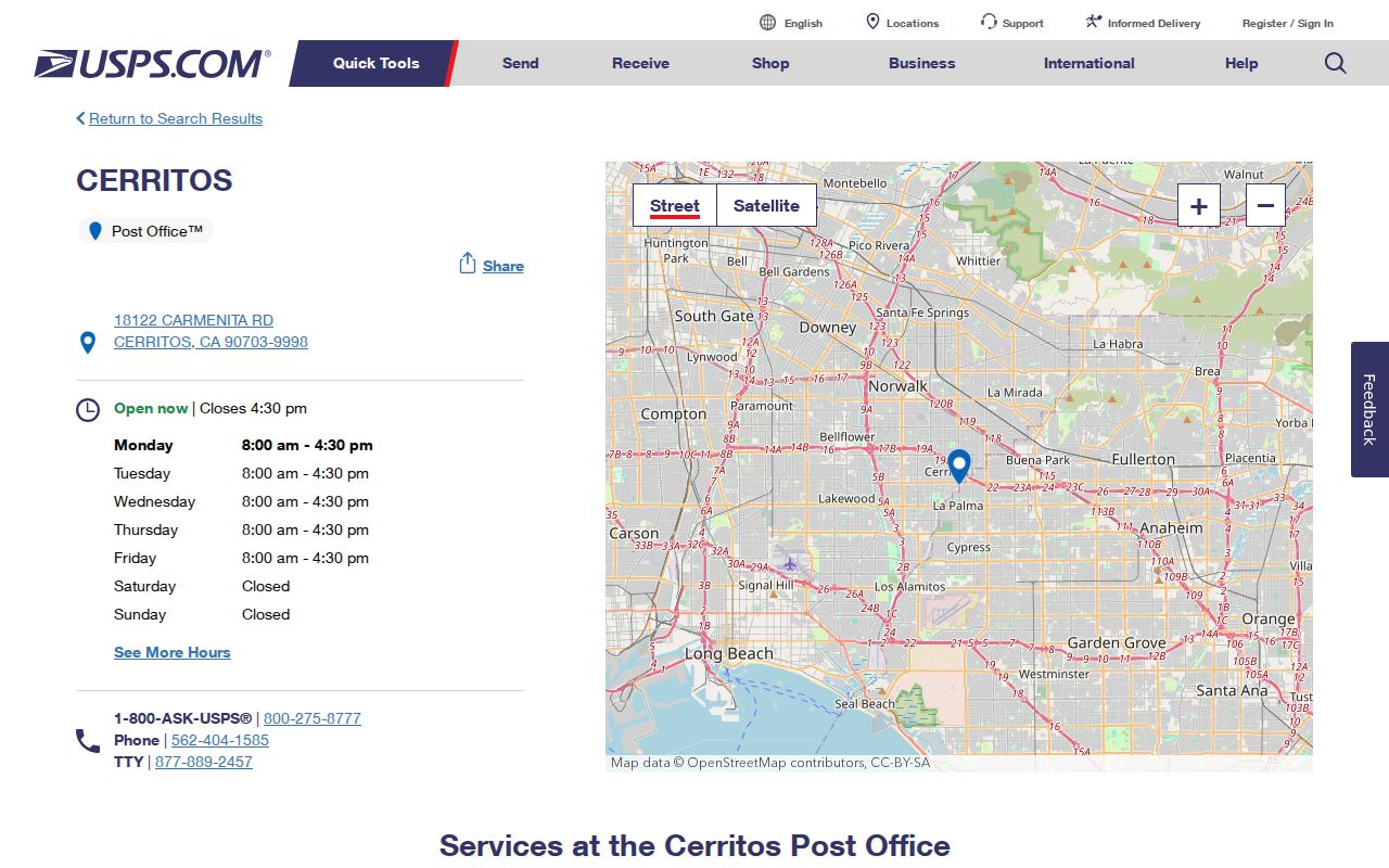
Postal proximity is a useful clue, not a city-boundary ruling. Confirm the address before attaching a record to Cerritos.
Cerritos AIN Outlasts Postal Labels
Historical property work often crosses two naming changes. Cerritos was Dairy Valley from incorporation in 1956 until the 1967 name change. The city grew from dairy and farm land into tract neighborhoods in a short span. A directory or deed may therefore use a former place name, county geography, or tract name even when the modern postal answer is simple.
The AIN, legal description, tract map, and recording data give the search a stable spine. A postal label can change or describe delivery rather than jurisdiction. A city label can reflect an older community. For a past household, pair the parcel key with the relevant directory year and the 1950 census rather than trying to force every source into 90703.
Cerritos city history records the incorporation and name change that make Dairy Valley a necessary search term.
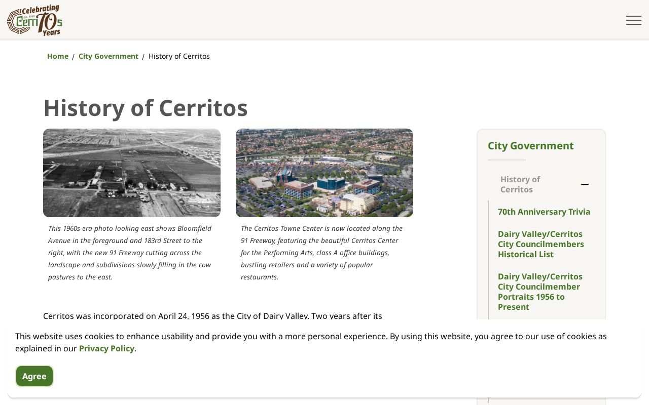
The history image adds the time layer that a current ZIP lookup cannot supply.
Cerritos ZIP Code Directory Without Overclaiming
A useful Cerritos ZIP code directory can list the verified postal area, show the station, explain the city-limit mismatch, and give a repeatable parcel workflow. It should not claim a ZIP-wide resident export where the official portals do not offer one. The Assessor is address/AIN keyed. GIS is map keyed. Voter status is person keyed. USPS is address keyed. Each answer belongs in its own column.
| Question | Best official route | Result to save |
|---|---|---|
| What ZIP serves this address? | USPS Lookup | Standardized city, state, ZIP, ZIP+4, and delivery format |
| Is the parcel in Cerritos? | Cerritos GIS and City jurisdiction pages | Map location, parcel relationship, and City context |
| Which county record holds the land? | Assessor AIN and RR/CC legal description | Parcel key, situs, tract/lot, and title path |
| Can a person verify registration? | County or state voter-status tool | Personal match and status, not a public list |
Edge check. Save USPS postal city, Cerritos GIS jurisdiction, and County Assessor AIN separately. They answer different questions and can disagree without an error.
The result is a ZIP code directory built for accurate research: narrow about 90703, clear about 90701 and 90630, and honest about the lack of a public ZIP-wide resident roll.
When a request moves from postal facts to a county or city record, carry the standardized address, ZIP+4 when returned, AIN, and legal description together. A City Clerk request should name the record class and date range, while a deed search should use a person and recording year. A voter-status check needs the person's own matching details. Keeping those routes separate prevents a mailing label from becoming an unsupported claim about ownership or a household.